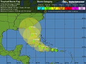
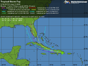
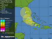
For the North Atlantic...Caribbean Sea and the Gulf of Mexico...
Surface observations and radar data from Puerto Rico and the
Dominican Republic show that the center of the low pressure area is
moving inland over the Dominican Republic. This system is
gradually becoming better organized...and NOAA and Air Force
Reserve hurricane hunter aircraft are currently investigating it.
A tropical depression could form at any time during the next day or
two...although when and where a depression might form is uncertain
due to interactions with the land mass of Hispaniola. Heavy rains
and gusty winds are expected over portions of Puerto Rico...the
Dominican Republic...and Haiti...and are expected to spread over
eastern Cuba and the southeastern Bahamas during the next day or
two. Interests in these areas...as well as the remainder of
Cuba...the remainder of the Bahamas...southern Florida...and
Jamaica...should monitor the progress of this system.
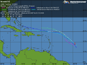
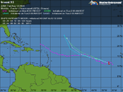
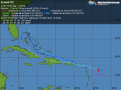
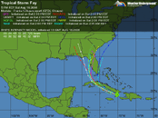
A broad area of low pressure centered about 750 miles east of the
Lesser Antilles is producing disorganized shower activity.
Development of this system...if any...should be slow to occur as it
moves west-northwestward at 10 to 15 mph.
Elsewhere.. tropical cyclone formation is not expected during the
next 48 hours.