Invest 93L Looks at Cozumel, then Florida

Please register or login

Welcome to ScubaBoard, the world's largest scuba diving community. Registration is not required to read the forums, but we encourage you to join. Joining has its benefits and enables you to participate in the discussions.

Benefits of registering include

  • Ability to post and comment on topics and discussions.
  • A Free photo gallery to share your dive photos with the world.
  • You can make this box go away

Joining is quick and easy. Log in or Register now!

DandyDon

Colonoscopy Advocate
ScubaBoard Supporter
Messages
53,645
Reaction score
7,825
Location
One kilometer high on the Texas Central Plains
# of dives
500 - 999
Hi everybody, this is Rob Carver, R&D Scientist for Wunderground, filling in for Jeff Masters.

Summary of the situation

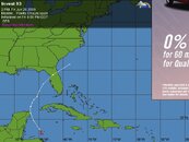
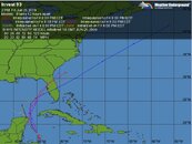
In the Tropical Weather Outlook NHC has tagged a tropical wave in the NW Caribbean Sea as Invest93L and believes that it has a 30-50% chance of developing into a tropical cyclone in the next 48 hours. As of now (11 PM PDT, June 26), the Hurricane Hunters are scheduled to investigate this area on June 28. The track models have Invest93L moving through the Yucatan Straits into the Gulf of Mexico. After that, most of the models take the cyclone north and east making landfall along a wide swath of Florida's Gulf Coast on Wednesday of next week. The intensity models predict that at landfall, the system will be a weak Category 1 hurricane or strong tropical storm.
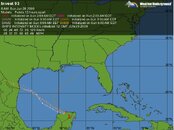
SH-08.jpg . SH-07.jpg
Click to enlarge:eyebrow:
 
Good news! It blew westward and inland...!
SH-04.jpg
Much Ado About Nothing: Invest93L

Posted by: JeffMasters, 12:29 PM GMT on June 28, 2009
Hi, this is Rob Carver, again filling in for Jeff Masters.

Invest93L is still present as of the 8am EDT Tropical Weather Outlook, but I'm extremely doubtful that it will reach even tropical depression status.

Invest93L's presentation on satellite imagery does not project the image of a strengthening storm. Convection, what there is of it, appears to be anchored over the Yucatan Straits and is not following the low-level circulation center. Also, microwave imagery indicates that the convection is weak, with relatively low rainfall rates.

It is worth noting that even if more convection forms after the circulation center moves into the Gulf of Mexico, there isn't much time for the storm to strengthen. By Tuesday evening, both the NAM and GFS 06Z model runs bring a weak front down into the Gulf, raising wind shear to the point that would dissipate Invest93L.

So, after considering the above, it's my opinion that Invest93L is not likely to intensify and will dissipate in a day or so.

Rob Carver
 

Back
Top Bottom