3 Storms Aim For Antilles: Anna, TD 3, I-90

Please register or login

Welcome to ScubaBoard, the world's largest scuba diving community. Registration is not required to read the forums, but we encourage you to join. Joining has its benefits and enables you to participate in the discussions.

Benefits of registering include

  • Ability to post and comment on topics and discussions.
  • A Free photo gallery to share your dive photos with the world.
  • You can make this box go away

Joining is quick and easy. Log in or Register now!

DandyDon

Colonoscopy Advocate
ScubaBoard Supporter
Messages
53,652
Reaction score
7,828
Location
One kilometer high on the Texas Central Plains
# of dives
500 - 999
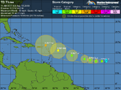
Edit: TD 3 now known as TS Bill

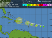
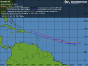
If you're headed for the Caribbean, you may well want to check out the progress of these possible threats...
Click thumbs for larger maps

Ana.gif * 90.gif * TD 3.gif

See details: Tropical Weather : Weather Underground
 
Last edited:
Looks like 90 has died out.

From Dr. Masters....
Ana near death

The Hurricane Hunters are in Tropical Storm Ana, and have found that the storm is very disorganized, and may not survive another day. Dry air continues to plague the storm, thanks to the large area of Saharan air the storm is embedded in. Ana's very rapid forward motion of 20 - 25 mph has stretched out the storm's circulation from circular to elliptical. This non-circular flow around the center has made the heavy thunderstorm activity less organized, and it may be difficult for the storm to hold together much longer. The outer rain showers from Ana are now on radar out of Martinique.

Nearly all of the computer models forecast Ana will dissipate over the next two days. If there is anything left of the storm by the time it encounters the rugged terrain of Hispaniola, that should finish Ana off. At this time, it does not appear that Ana will be moist enough to cause a major flooding disaster on Hispaniola.
Ana.gif

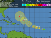
Tropical Storm Bill continues strengthening

Tropical Storm Bill continues to gather strength in the middle Atlantic Ocean, and appears poised to become a major Cape Verdes-type hurricane later this week. Water vapor satellite loops show that Bill has developed a core region of heavy thunderstorms that should be fairly impervious to the dry Saharan air to its northwest, and the storm should be able to start building an eyewall tonight.

Wind shear is low, 5 - 10 knots, and is forecast to be in the low range for the next three days. With Sea Surface Temperatures at 27.5°C, and ocean heat content sharply increasing 2 - 3 days from now, Bill should be able to intensify to a major Category 3 or 4 hurricane by Wednesday. At that time, some increasing shear may limit further intensification.

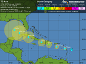
The big news is that our most reliable computer model from last year--the ECMWF model--appears to have made the right call yesterday, forecasting that a major trough of low pressure would develop along the U.S. East Coast, turning Bill more to the north. All of the other models have now jumped on the ECMWF bandwagon, forecasting that Bill will pass well north of the Lesser Antilles Islands. The UKMET model, which was resisting forecasting the northward turn, has now joined the other models in its latest 12Z run. The main drama with Bill this week will be to see how close it passes to Bermuda. Several models have Bill passing within 200 miles of Bermuda on Saturday. It is too early to be confident that Bill will miss the U.S. East Coast.
Bill_5day.gif
 
https://www.shearwater.com/products/peregrine/

Back
Top Bottom