


boljakool
Contributor
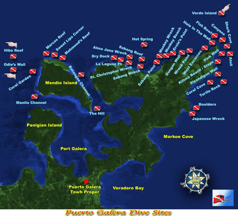
I just finished working on these dive site maps of Puerto Galera & Anilao, and I thought that this could be helpful for anybody who might be planning to go diving in the Philippines.
Please feel free to give me information for any correction of locations, names, or anything else that you may find in these images.
Puerto Galera
Anilao

Please feel free to give me information for any correction of locations, names, or anything else that you may find in these images.
Puerto Galera
Anilao

