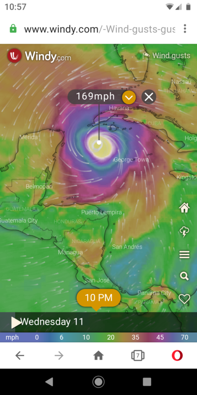
By windy.com's forecast, Eta looks like it will become a monster by the middle of next week. The wind speed forecast shown on the screenshot is for "gusts". But, still...


You are using an out of date browser. It may not display this or other websites correctly.
You should upgrade or use an alternative browser.
You should upgrade or use an alternative browser.
Hurricane Eta
- Thread starter Snoweman
- Start date
Please register or login
Welcome to ScubaBoard, the world's largest scuba diving community. Registration is not required to read the forums, but we encourage you to join. Joining has its benefits and enables you to participate in the discussions.
Benefits of registering include
- Ability to post and comment on topics and discussions.
- A Free photo gallery to share your dive photos with the world.
- You can make this box go away
JFS
Contributor
Keeping my eyes on that one...
cozcharlie
Contributor
Looking at that also. Not sure if it will be Eta or Theta or nothing at all.
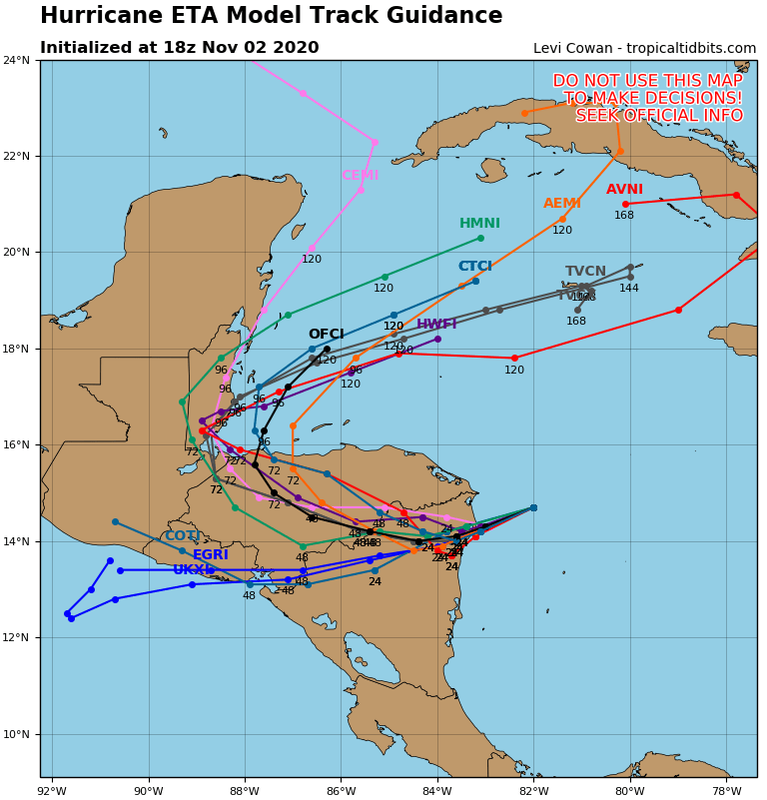
I think (and much more importantly NHC has said ) forecasts may not be correctly handling the impact that mountains in western Nicaragua and especially Honduras will likely have on a relatively slow moving storm. 48-72 hours over land with 6,000+ foot mountains will hopefully shred the circulation.
Even if it does get shredded , the remnants might reform into something and I think models may be seeing that . Not sure if that would be Eta or Theta. Models that far out extremely unreliable, but obviously need to watch closely.
CajunDiva
Contributor
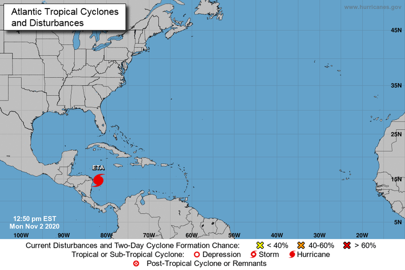
The National Hurricane Center says it will impact Nicaragua. This should not be a threat to Cozumel.

The National Hurricane Center says it will impact Nicaragua. This should not be a threat to Cozumel.
View attachment 622014
It's where it goes after and how long it sits soaking up power that worries us here
CajunDiva
Contributor
Agreed. After all, it IS 2020!
The National Hurricane Center says it will impact Nicaragua. This should not be a threat to Cozumel.
View attachment 622014
It impacts Nicaragua, but then heads back out to sea and gets stronger. My original images are forecasting past this one.
When the thing goes from a Cat 1 to a Cat 4 overnight and just seems to be wandering, makes this newbie worried. Looks like two or three more days of uncertainty and ****** weather here......

First time we’ve used Eta and only second time we’ve been past the regular alphabet names into the Greek overflow.
2005 technically had the same number of storms, but they didn't name the last one because it was after November 30th.
Similar threads
- Replies
- 13
- Views
- 1,135


