New diver's ramp location at Lake Jocassee, reviews?

Please register or login

Welcome to ScubaBoard, the world's largest scuba diving community. Registration is not required to read the forums, but we encourage you to join. Joining has its benefits and enables you to participate in the discussions.

Benefits of registering include

  • Ability to post and comment on topics and discussions.
  • A Free photo gallery to share your dive photos with the world.
  • You can make this box go away

Joining is quick and easy. Log in or Register now!

Oh, OK sorry. If you look at your map, the peninsular with the new ramp looks kinda like a boot, sort of like a horizontal Italy. They could do better if they made the stairs in the area just N of the boot's heel, facing E. But they made the stairs as if they had a kiddy pool in mind.

I'm assuming that the boat-ists pay more money for lake access. If not...that's ****** up.
 
I'm assuming that the boat-ists pay more money for lake access. If not...that's ****** up.
Their website only says "$8 adults; $5/ SC seniors (age 65 & older); $4 children ages 6-15; ages 5 and under, free."
 
Well....it IS South Carolini....
 
Another set of dives today, and starting to get an overall feel for the area. Taking an idea from @MattK911 , I share todays first dive on a depth map below. The red line shows first half of dive following contour at depth of 60-70' and returning along yellow line at depth 45-55'. Green lines are beginning and end of dive, in the less interesting silt bottom shallow areas. Water was down 4-5' compared to last few weeks, just reaching the bottom of the entry stairs. Temp at 65' was 76 degrees.

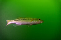
This route made for an enjoyable dive, with plenty of rock and stump/log features all along the way. A highlight was having a school of 10-12 bass swimming fairly close by in a half circle around us.
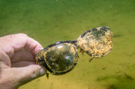
Our treasure(junk) found today includes 2 more pairs of sunglasses, a single blade paddle, a new spool of yellow line, and an old iphone.

jcd.png
 
Is the green line your surface swim? OK, so the idea is to simply go out further away.

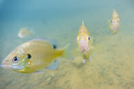
Couple of my pics attached.DSC05424-32.jpg DSC05429-32.jpg DSC05442-32.jpg
 
So true. I absolutely do not understand these changes. Like, there were not enough ramps for the motor boats? But they hardly ever used the ramp at the end of the road. And to make things worse, they build the stairs facing the shallowest bay of the lake.


According to Dr. Bill, they were planning to put in a new boat ramp @ the new site until they found out how much that would cost.
 
Is the green line your surface swim?

Green line is also part of the dive, we swam out to the platform marked with jug bouy and descended there. I just used green to indicate the shallower sections of the dive that were less interesting.
 
Can you tell me if the Vis been affected by recent rains?
Also are dogs allowed in the park?

Thanks
Bill
 
Did some kayaking with wife and grand kids today. Saw a large group of divers deep in the bay between the old and the new diving ramps, but closer to the old ramp. What's the point of diving there?
 
https://www.shearwater.com/products/teric/

Back
Top Bottom