rspanscuba
New
Tried the Lifeline for the first time last weekend. Really nice to drop straight down on the sailboat at Del Monte Beach based on GPS instead of hunting around in 10-15' vis.
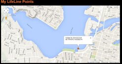
Figured I'd try "buried treasure mode" to store some GPS points. But true to the manual, it stores only every 100m. That appears to be true even if I manually power the Lifeline off, move a short distance, then power it back on (and wait for it reacquire lock). So I'm not sure where I actually dropped down, since it was less than 100m from the last logged point.
I guess the best I can do at the surface is take a pair of pictures of the UI with the current Lat/Long (I'm diving in 5-mil gloves so my handwriting's atrocious...) I can do that underwater, too - at least, with the current firmware. That should work even if I send it up on a line, wait a minute, then pull it back down. Even if I haven't moved 100m since I last sent it up, I'll still get an updated display I can photograph.
However, I'm concerned about the new firmware (0.80+). The manual says it will display only Lat, Lon, or UTC, and will require a button press to toggle between them - which can only be done at the surface. And it looks like it'll only display down to 0.01 min (~60'), while the current firmware displays more digits. 60' is a practically infinite distance in 10' vis. So I'm worried it'll be much less useful underwater.
So, questions:
1) In buried treasure mode, when does it decide to take a new point? Only if the treasure is 100m+ from the last time I sent it up? Only if it's been at least ??? min since it last had GPS lock?
2) Any tricks for forcing it to take a new point? (Other than making sure I swim underwater at least 100m from the last one... )
)
3) Do we really lose the 3rd digit of displayed lat/lon in the new 0.80+ firmware?
4) Firmware upgrade is always manual, right? So I don't need to worry it'll upgrade on its own?
And a wishlist:
1) A way to force it to save a new point at the surface.
*or*
2) A mode where it will save a new point whenever it *loses* GPS lock. So whenever I submerge, or send it up and pull it back down, it'll save those coords.
* or *
3) A display mode with 3+ significant digits for both lat/lon. Something like:
36 12.345'N
121 50.678'W
I can take a picture of that when I need to store a point.
Thanks,
Randall
Figured I'd try "buried treasure mode" to store some GPS points. But true to the manual, it stores only every 100m. That appears to be true even if I manually power the Lifeline off, move a short distance, then power it back on (and wait for it reacquire lock). So I'm not sure where I actually dropped down, since it was less than 100m from the last logged point.
I guess the best I can do at the surface is take a pair of pictures of the UI with the current Lat/Long (I'm diving in 5-mil gloves so my handwriting's atrocious...) I can do that underwater, too - at least, with the current firmware. That should work even if I send it up on a line, wait a minute, then pull it back down. Even if I haven't moved 100m since I last sent it up, I'll still get an updated display I can photograph.
However, I'm concerned about the new firmware (0.80+). The manual says it will display only Lat, Lon, or UTC, and will require a button press to toggle between them - which can only be done at the surface. And it looks like it'll only display down to 0.01 min (~60'), while the current firmware displays more digits. 60' is a practically infinite distance in 10' vis. So I'm worried it'll be much less useful underwater.
So, questions:
1) In buried treasure mode, when does it decide to take a new point? Only if the treasure is 100m+ from the last time I sent it up? Only if it's been at least ??? min since it last had GPS lock?
2) Any tricks for forcing it to take a new point? (Other than making sure I swim underwater at least 100m from the last one...
3) Do we really lose the 3rd digit of displayed lat/lon in the new 0.80+ firmware?
4) Firmware upgrade is always manual, right? So I don't need to worry it'll upgrade on its own?
And a wishlist:
1) A way to force it to save a new point at the surface.
*or*
2) A mode where it will save a new point whenever it *loses* GPS lock. So whenever I submerge, or send it up and pull it back down, it'll save those coords.
* or *
3) A display mode with 3+ significant digits for both lat/lon. Something like:
36 12.345'N
121 50.678'W
I can take a picture of that when I need to store a point.
Thanks,
Randall


