Back to Marineland. A non-dive report

Please register or login

Welcome to ScubaBoard, the world's largest scuba diving community. Registration is not required to read the forums, but we encourage you to join. Joining has its benefits and enables you to participate in the discussions.

Benefits of registering include

  • Ability to post and comment on topics and discussions.
  • A Free photo gallery to share your dive photos with the world.
  • You can make this box go away

Joining is quick and easy. Log in or Register now!

MaxBottomtime

Contributor
Scuba Instructor
Divemaster
Messages
10,421
Reaction score
12,461
Location
Torrance, CA
# of dives
2500 - 4999
Jeff Shaw was kind enough to meet me at Marineland this morning for the three week anniversary of the Great Wagon Disaster of 2009. The ocean was dirty with large surf and whitecaps everywhere. It made me glad I wasn't missing anything.
The new public access parking lot is at Point Vicente Fishing Access, better known as Cardiac Hill. It's about a 100 mile hike to the beach at Marineland, but there is street parking available near the old trail. I hope to be hauling my gear down the trail on February 21, if I can get up the nerve to look at my wagon by then.
Phil.jpg
 
I noticed to day when I flew over that the parking lot had been removed. I did also see the new lot. It is just north of the big switchback and is quite large.

When this is all finished the exhisting trail will still be available right? Any idea when we will gain access to the new 'real' lot?

Hopefully you are healing well and you can get back at it on the 21st!
 
Divebum Don said that the guard let a group in earlier in the day and they parked near the hotel. An hour later, Jeff and I were not allowed in. Maybe Jeff just scared them. :)
 
Thanks for the heads up Phil. I saw your post on Psycho's Blog too. I was gonna go check and see if the trail was unimpeded because Thursday is looking good enough for my first Long Point dive! Hopefully I won't be going back to the 120 reef for sometime. Thanks:)
 
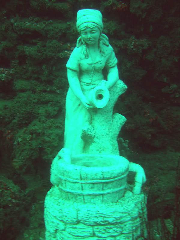
If you make it to the Point, drop down a bit west of the metal grate on the hill to the left of the hotel and beyond the kelp about 150 feet from shore. The larger pinnacles, statue and the larger variety of nudibranchs, sponges and fish are in 50-65 feet. I usually spend a short time there, then follow the perimeter of the reef all the way back to the cove. On the way back from the point you may see the large anchor, chain, field of tube anemones and kelp. As you get close to the cove you'll see kelp growing on single rocks about ten feet off the reef. Once you reach the end of the reef to your left, follow the sand in to the exit. If you take your time and don't kick hard you can cover the full quarter mile and still have a few psi left. The statue is next to Ted's Pinnacle, almost directly south of the post.
DSCF0454.jpg


DSCF2517.jpg


Picture005-2.jpg


Picture004-3.jpg


Marineland_map1.jpg
 
Last edited:
If you make it to the Point, drop down a bit west of the metal grate on the hill to the left of the hotel and beyond the kelp about 150 feet from shore.

Thanks for the explanation. SpKelpDiver and I are pretty stoaked to finally try over there. In about what feet of water is the descent point "150 feet from shore"? Is there a compass heading I can take to find the statue once submerged? Should I surface swim directly in line with the grate to find my descent spot? Is it a noticeably large grate?

Thanks again for the help and pictures. I can't wait to get out there:D
 
The grate is in the middle of the hill to the left of the hotel. It's about four feet square. Drop just south of it, between the grate and the post on the big rock. The kelp ends in about 35 feet. If you drop there just head 180 degrees until you get to 55-60 feet. Ted's Pinnacle is the tallest one there, but it's not always easy to find. I placed the statue on the east side of the pinnacle, near the crack between Ted's and a smaller pinnacle to the north. I usually follow the gorgonians south once I drop. They are perpindicular to the shore, so I really never use a compass at Marineland.
After leaving the pinnacle you can head east and follow the perimeter of the reef, or head north until you are in about 35 feet, then head east to save a little air.
Picture068-2.jpg

The shallows at the Point. Swim against the gorgonians to head south.

Picture067-2.jpg


Picture057-2.jpg

As you get deeper, the rocks get taller. Ted's Pinnacle is about twenty feet tall. The south side is a verticle wall covered by sponges, nudis and invertebrates. The north side is the crack, which is almost always filled with fish. Sometimes it's rockfish, or rubberlip seaperch, but lately Sheephead have filled the crack.
If you enter at the cove it's about a 25 minute surface swim to the drop point. If conditions are calm it's a nice, relaxing kick on your back. If it's rough you'll wish you had gone to Shaw's Cove. If it's really calm you might consider entering at the Point, but that's a learned skill and a LOT of divers have been injured there.
 
Last edited:
Beautiful Shots! Thanks for the explanation. It should really help quite a bit once we get there. That last shot looks like a monster dorid is hangin out on that lower rock. Very cool! Can't wait! Thanks for the help:)
 
Can one of you please draw on the arial picture views with some sort of graphic drawing program, to show exactly the spots which you speak of? Thanks
 
https://www.shearwater.com/products/perdix-ai/

Back
Top Bottom