Sonar or bottomfinder for finding dive sites

Please register or login

Welcome to ScubaBoard, the world's largest scuba diving community. Registration is not required to read the forums, but we encourage you to join. Joining has its benefits and enables you to participate in the discussions.

Benefits of registering include

  • Ability to post and comment on topics and discussions.
  • A Free photo gallery to share your dive photos with the world.
  • You can make this box go away

Joining is quick and easy. Log in or Register now!

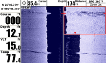
SeaKing 98 has it nailed, I have the Garmin gpsmap188/sounder set up the same way...spend less time looking at your screen and more time looking here:

http://map.marineplanner.com/mapping/chart/chartindex.cfm

Or here:

www.topozone.com

You would be amazed at the number of dive sites I have found and dive around Puget Sound, that are not mentioned anywhere. Learn to read charts and notices to mariners on the marine planner site, the information is unbelievable, print the chart chunk with the gps numbers and the most rudimentery fish finder around will be enough to drop you right on the site.
If you are going to be out in the salt you need to know how to read charts anyway, and a GPS with backup charts should be a requirement,
Johnny
 
I map coral reefs and other underwater structures with a Lowrance 420 or 17MT. with an airmar transducer the 17MT will go as deep as 300ft in salt water (we mapped a reef off Belize that was that deep). The image in my avatar is a newly discovered seamont in PNG mapped witha fish finder.

Before buying any fish finder for that purpose you need to ask the sonar cone angle, frequency and power. Cone angle will tell you how wide the beam will be at depth. Frequency & power will tell you how deep it will go (lower frequency = deeper).

There are also sidescan sonars like the humminbird and the one from Burton Electronics that are reasonably priced.

JL
 
homo maris:
I map coral reefs and other underwater structures with a Lowrance 420 or 17MT. with an airmar transducer the 17MT will go as deep as 300ft in salt water (we mapped a reef off Belize that was that deep). The image in my avatar is a newly discovered seamont in PNG mapped witha fish finder.

Before buying any fish finder for that purpose you need to ask the sonar cone angle, frequency and power. Cone angle will tell you how wide the beam will be at depth. Frequency & power will tell you how deep it will go (lower frequency = deeper).

There are also sidescan sonars like the humminbird and the one from Burton Electronics that are reasonably priced.

JL

Nice Avatar! How do you log your lat/lon with your depth?
 
Dudes slow down are you doing ship wreck hunting for a living? Looking for the next big find?
Buy a side scan rig! with a Magnometer!

If not man save your money! dont make this a big deal and now I will give you my 3 cents!
On fresh water I use a cheap Eagle 168 100 watts 800 Peak to Peak 200KHZ cost several years back less than $100 I use it to find wrecks and DID! And use it to locate wrecks with bad no#s GPS conversions from old Loran and the trick is ,,,,, to zoom on just the depth your looking and most units do this! they cut out the crap, narrow the beam and can give you some good detail,wish I had video of one wreck we have in 165fsw a schooner with both masts and on a pass over you could make them out and the front bow spirit!
In Salt water I would use the 727 Humminbird less than $260 over 1000 watts of power and you can pound the bottom,see the ledges and at a 100fsw cover a nice area at a narrow cone on zoom!
One thing most folks do wrong is the use a locator depth sonar/fishfinder in fish finding mode and loose all bottom structure,
Now the 3-d units I am not impressed buy them, the new Humminbird side scan is good in water less than 150fsw and I am sure that means about a 100'fsw so its not worth a $1000 clams,
So save the cash for more gas as it aint going to be cheap this dive season! and get your self something with the power, less all the other stuff like GPS,
as I like to keep my GPS in my sweaty hands as some folks are know to grab them for No#s
Good luck and dive safe!
Brad Ingersoll
 
homo maris:
Lat/Lon is captured with a GPS.
JL

How do you log it? I want to get Lat/Lon/Depth in the same file as cheaply as possible. I have an open boat so I don't really want to go the laptop route. I was looking at a few loggers but I can't get one that will log the three parameters. Lots of them will log GPGGA(GPS Sentence) and get altitude but won't accept a second sensor providing depth.
 
DennisS:
How do you log it? I want to get Lat/Lon/Depth in the same file as cheaply as possible. I have an open boat so I don't really want to go the laptop route. I was looking at a few loggers but I can't get one that will log the three parameters. Lots of them will log GPGGA(GPS Sentence) and get altitude but won't accept a second sensor providing depth.

The Lowrance fish finder models 17MTand 480 can record their data onto a memory card.
File saved this way are called SLG files. They include Lat/Lon/depth and sonar echo.
To extract the Lat/Lon/Depth and even temperature you need to use the free SLG2TXT.EXE program that comes with SonarViewer that you can download from the Lowrance site.

What I do is record the data at sea then when on shore download it into a laptop, extract lat/lon/depth with SLG2TXT and use a geostatisitcal algorithm (e.g. Kriging) to interpolate the missing surface between the data points. The result is a 3D model of a reef.

The whole technique is describe in the Case Study: Mapping Half Moon Caye’s Reef Using the Adaptive Bathymetric System (ABS)

I hope that it helps.
JL
 
moneysavr:
Dudes slow down are you doing ship wreck hunting for a living? Looking for the next big find? Buy a side scan rig! with a Magnometer!
If not man save your money!
Yeah... there's nothing scuba divers hate more than spending money on expensive toys. Those fancy side-scan units cost almost as much as my drysuit.

Seriously though, if you already bought a boat for diving, good electronics are a drop in the bucket by comparison, and IMHO are likely make the investment more rewarding.
 
MSilvia:
Yeah...

Seriously though, if you already bought a boat for diving, good electronics are a drop in the bucket by comparison, and IMHO are likely make the investment more rewarding.


True Matt,'
But I am just telling folks that you can spend far less and get more than you need or spend far more and get less!
A good boat is just a extension of your dive kit,IMO and less than most tec dudes drop on a kit in several years,Then they just dive quarrys with it-or rec range dives!

Man that must be some drysuit!
Dive safe,
Brad
 
I finally went for the Hummingbird997. I have dual inboards so the transom mount transducer provided a really bad picture with lots of interference. I installed the thru hull and it worked fine.

The attached picture shows two lines, the lower one was the first crossing on a southerly heading. The second one was heading north after turning around with the right side magnified. I'm just learning how to use it but it does have potential. It will never be a Klein 3000 but I think I can do better with practice. It still beats the 2D that just shows a bump.

The object being surveyed is an east-west stack of concrete jacks, each jack is approx 4ft in length, the entire structure is a couple hundred yards long. I want to get good enough to make out individual jacks.
 

Attachments

  • ero-jacks2.gif
    ero-jacks2.gif
    138.3 KB · Views: 249
https://www.shearwater.com/products/swift/

Back
Top Bottom