LunaBuna
Registered
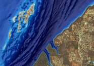
Navionics has added a SonarChart Shading feature which uses shades of blue to highlight bottom contours (see pic). It seems like this would be a quick way to identify potential ledges. Anybody have any experience with this?
Satellite Overlay with SonarChart™ Shading
Satellite Overlay with SonarChart™ Shading