

You are using an out of date browser. It may not display this or other websites correctly.
You should upgrade or use an alternative browser.
You should upgrade or use an alternative browser.
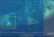
My Google Earth Project!
- Thread starter ScubaBrett22
- Start date
Please register or login

Welcome to ScubaBoard, the world's largest scuba diving community. Registration is not required to read the forums, but we encourage you to join. Joining has its benefits and enables you to participate in the discussions.
Benefits of registering include
- Ability to post and comment on topics and discussions.
- A Free photo gallery to share your dive photos with the world.
- You can make this box go away

That's pretty awesome!
OP
ScubaBrett22
Lionfish Slayer
Thanks!! I am trying to see if there are any other SPA Zones to add there half to be more. LoL
SPA Zone?
OP
ScubaBrett22
Lionfish Slayer
You don't know what a SPA Zone is ??? Okay Np a (SPA) Zone is a "Sanctuary Preservation Area"
Have fun reading- LoL
These are regulations that apply throughout the entire area of the Sanctuary, including other protected areas and Sanctuary zones. The purpose of these regulations is to protect Sanctuary resources from both direct and indirect threats. These regulations focus on habitat protection, reducing threats to water quality, and minimizing human impact to delicate resources. The following activities are prohibited Sanctuary-wide:
* Moving, removing, taking, harvesting, damaging, disturbing, touching, breaking, cutting, or otherwise injuring, or possessing any living or dead coral, or coral formation, or attempting any of these activities, except as permitted by the FKNMS regulations
* Discharging or depositing trash or other pollutants.
* Dredging, drilling, prop dredging or otherwise altering the seabed, or placing or abandoning any structure on the seabed.
* Operating a vessel in such a manner as to strike or otherwise injure coral, seagrass, or other organisms. attached to the seabed, or cause prop-scarring.
* Having a vessel anchored on living coral in water less than 40 feet deep when you can see the bottom. Anchoring on hardbottom is allowed.
* Operating a vessel at more than idle speed/no wake within 100 yards of residential shorelines, stationary vessels, and navigational aids marking reefs.
* Operating a vessel at more than idle speed/no wake within 100 feet of a "divers down" flag.
* Diving or snorkeling without a dive flag.
* Operating a vessel in such a manner which endangers life, limb, marine resources, or property
* Releasing exotic species.
* Damaging or removing markers, mooring buoys, scientific equipment, boundary buoys, and trap buoys.
* Moving, removing, injuring, or possessing historical resources.
* Taking or possessing protected wildlife.
* Using or possessing explosives or electrical charges.
* Harvest and possession of marine life species -- tropical fish, invertebrates, and plants -- except in accordance with rules 68B-42 of the Florida Administrative Code.
OP
ScubaBrett22
Lionfish Slayer
You don't know what a SPA Zone is ??? Okay Np a (SPA) Zone is a "Sanctuary Preservation Area"
Have fun reading- LoL
These are regulations that apply throughout the entire area of the Sanctuary, including other protected areas and Sanctuary zones. The purpose of these regulations is to protect Sanctuary resources from both direct and indirect threats. These regulations focus on habitat protection, reducing threats to water quality, and minimizing human impact to delicate resources. The following activities are prohibited Sanctuary-wide:
* Moving, removing, taking, harvesting, damaging, disturbing, touching, breaking, cutting, or otherwise injuring, or possessing any living or dead coral, or coral formation, or attempting any of these activities, except as permitted by the FKNMS regulations
* Discharging or depositing trash or other pollutants.
* Dredging, drilling, prop dredging or otherwise altering the seabed, or placing or abandoning any structure on the seabed.
* Operating a vessel in such a manner as to strike or otherwise injure coral, seagrass, or other organisms. attached to the seabed, or cause prop-scarring.
* Having a vessel anchored on living coral in water less than 40 feet deep when you can see the bottom. Anchoring on hardbottom is allowed.
* Operating a vessel at more than idle speed/no wake within 100 yards of residential shorelines, stationary vessels, and navigational aids marking reefs.
* Operating a vessel at more than idle speed/no wake within 100 feet of a "divers down" flag.
* Diving or snorkeling without a dive flag.
* Operating a vessel in such a manner which endangers life, limb, marine resources, or property
* Releasing exotic species.
* Damaging or removing markers, mooring buoys, scientific equipment, boundary buoys, and trap buoys.
* Moving, removing, injuring, or possessing historical resources.
* Taking or possessing protected wildlife.
* Using or possessing explosives or electrical charges.
* Harvest and possession of marine life species -- tropical fish, invertebrates, and plants -- except in accordance with rules 68B-42 of the Florida Administrative Code.
I copy and pasted from Regulations in the Florida Keys NMS
CheddarChick
Contributor
Very Cool....
OP
ScubaBrett22
Lionfish Slayer
I Just Noticed i can't attach it is to big =O
OP
ScubaBrett22
Lionfish Slayer
Tell me if this works I tried something different.
4shared.com - online file sharing and storage - download Florida Keys SPA Zones.kmz
4shared.com - online file sharing and storage - download Florida Keys SPA Zones.kmz
OK, I opened Google Earth, then I clicked on your file and selected "run" and I see SPA zones but I'm not convinced they are the ones you did...what tags did you put on yours? (Not saying you didn't do the work Brett, I'm saying I'm not sure I downloaded it correctly).
If I am supposed to "save" instead of "run" where to save? I know I could figure it out on my own but it's late and I have other stuff to complete tonight.
It's a cool project to work on, Brett! Is this for school or just for fun?
If I am supposed to "save" instead of "run" where to save? I know I could figure it out on my own but it's late and I have other stuff to complete tonight.
It's a cool project to work on, Brett! Is this for school or just for fun?
Similar threads
- Replies
- 6
- Views
- 521
- Replies
- 0
- Views
- 374
- Replies
- 16
- Views
- 993
- Replies
- 12
- Views
- 1,099
- Replies
- 0
- Views
- 402

