


OP
ScubaBrett22
Lionfish Slayer
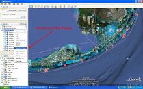
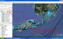
Well You have to Download and Save to your desktop. Then you open the file on your desktop and it should open google earth. Then it should show up in the Temporary Places under a folder called Florida Keys SPA Zones. Each SPA Zone is its on earth with it's name.
I wanted to do this for a long time to help me out in the key's when i am boating. This is just for fun and i hope Google Earth will accept my design and put it on Google Earth Mobile but who knows?")
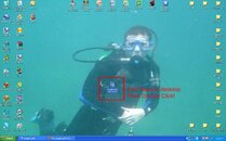
I will add a few pictures to help you out!!! Sorry it's a little fuzzy =)
I wanted to do this for a long time to help me out in the key's when i am boating. This is just for fun and i hope Google Earth will accept my design and put it on Google Earth Mobile but who knows?
I will add a few pictures to help you out!!! Sorry it's a little fuzzy =)
Attachments


Last edited:

