Alpena Sink Holes???

Please register or login

Welcome to ScubaBoard, the world's largest scuba diving community. Registration is not required to read the forums, but we encourage you to join. Joining has its benefits and enables you to participate in the discussions.

Benefits of registering include

  • Ability to post and comment on topics and discussions.
  • A Free photo gallery to share your dive photos with the world.
  • You can make this box go away

Joining is quick and easy. Log in or Register now!

I'm running charters this year and the Middle Island sink is a regular off gas stop after doing New Orleans or one of our technical dives like the Windiate.
BopiOverview.jpg

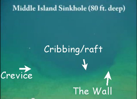
This is an aireal of the Middle Island sink that is just about 100' north of Middle Island. I marked it up to talk about where the different areas are. It has both the purple mat algae and the white "wedding veil" algae. The spot north of the crevice was the NOAA buoy. Somebody pulled it off the ledge into the main hole in 2009. Those flashing buoy lights still worked at 20'.
RB_MIsink01.jpg

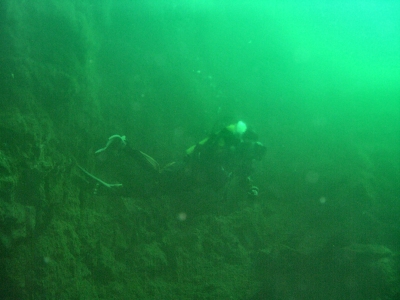
When you drop down the wall you will pass through a halocline. Above is more murky lake water, below is the clear (yellow tinged) spring water.

SinkHolePage.jpg

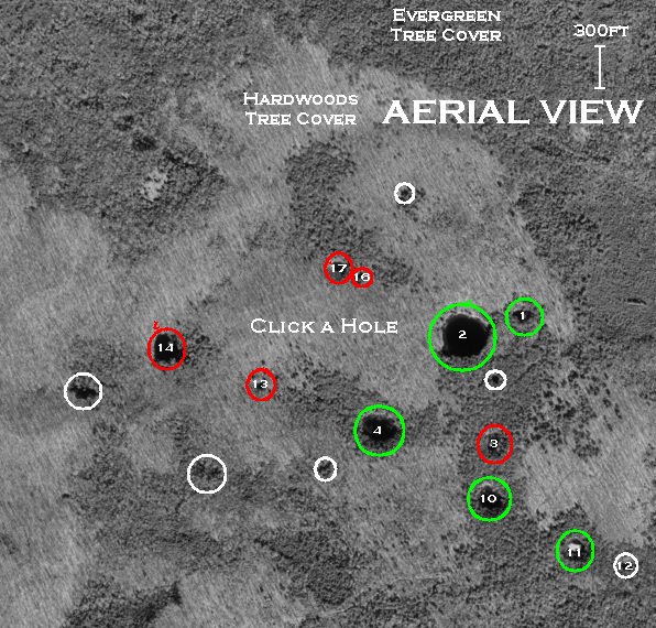
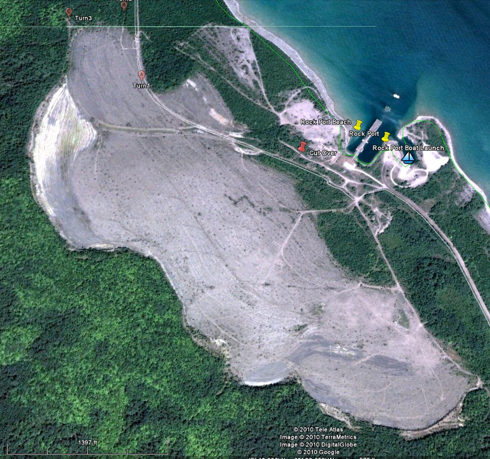
This is another aireal of the sinks NW of Rock Port boat launch.

The next couple are shots of two of these land-locked sinks.
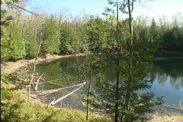
The Top is the Big Sink N45 12.797 W83 24.463
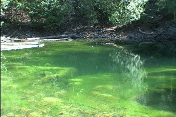
The bottom one is Sink 11
Sink2a.jpg

Sink11f.jpg
 
Last edited:
Dam, you got me going on these land locked sinks!
I have dove the Big Sink...with Mike and another buddy. We got a 6 wheeler back in there and was lucky that we did not get caught. A horse pack would be the way to go or better yet take a snowmobile out in the winter time. We found the edge of the dropoff in a 45' deep plateau. The hole seemed to suck up the light from my HID wreck cannister. I had a wet suit zipper failure and got cold, my buddies got cold feet prefferring to watch Joey and see if he gets sucked in rather than swim shoulder to shoulder. So we never did probe the depths. A researcher said he marked it as 60' deep, an old time diver said years ago he penetrated a suspended solids layer at 75' and bottomed out at 90' in zero viz.

Other than the Big Sink the others have a real steep, rock strewn shore line thirty feet below the forest. Aireal lines would have to be run to get gear up and down to the shoreline. In the winter a toboggan could be used to transport gear down and then an ice dive could place you right over the dropoff.

This series of sinks are spaced no more than a couple of hundered feet apart over a 1/4 mile of valley.

I will be at Seahorses Shipwreck Festival. Look for the Thunder Bay Underwater preserve booth.
 
Sounds like Sanctum... In Alpena Michigan.
 
Michigan's geology basically looks like layers of deposits layed upon one another in the shape of bowls. The deepest part of the bowl, thousands of feet below ground level, is around Lansing...do I dare say it??? It's the pits. Along these bowls edges rings of older and older rock come to the surface the farther you go from the center. Rock Port quarry is Devonian or 350 millon years old and is a treasure trove of fossils.
Quarry.jpg


I have a picture of a fossil of an armor plated fish called a "placoderm"
Placoderm.jpg


Softer layers of limestone dissolve away beneath harder layers and form underground rivers which excellerates errosion until the surface layer collaspes and a sink hole is formed.

Ty Black, State gelogist, thinks our aquifer is 800-900 feet down but then how does anyone know how this depth varries along the edge of this natural bowl? Dr. Bopi who has studied the Middle Island and 330' deep sink, in Lake Huron off of Rock Port, said that the chemistry of the land locked sinks is different and that this might indicate they were formed by a different aquifer. There has been no known diving surveys done of all the Rock Port sinks and the possibility that they are connected in some sort of diveable cave system is intriguing. I have been formulting a plan but as yet have been unable to ignore my need to earn a living to devote the time needed to explore these wonders.
 
The sink holes are easy to access with a mountain bike hauling a children's cart loaded with dive gear and cooler!!! Makes for a real fun adventure!! Use google earth to plot your best course. Sometimes parking at Bell Bay is a better option than Rockport.

Stop and see Joe at the festival this weekend at the Thunder Bay booth and he will fill you in. Also Mike and Keith will be around there too!!
 
The Thunder Bay Underwater Preserve Committee is working with Alpena Township to get access to the sink hole in Misery Bay through property owned by the township. The Misery Bay sink is just as unique as the Middle Island sink.

If any diver wants to help in this process, please email Alpena Township and tell them you are interested in diving this location. The more interest the public shows, the more likely we will be able to get access. www.alpenatownship.com
 
https://www.shearwater.com/products/swift/

Back
Top Bottom