Smith Mountain Lake - Underwater town - Fact or Fiction?

Please register or login

Welcome to ScubaBoard, the world's largest scuba diving community. Registration is not required to read the forums, but we encourage you to join. Joining has its benefits and enables you to participate in the discussions.

Benefits of registering include

  • Ability to post and comment on topics and discussions.
  • A Free photo gallery to share your dive photos with the world.
  • You can make this box go away

Joining is quick and easy. Log in or Register now!

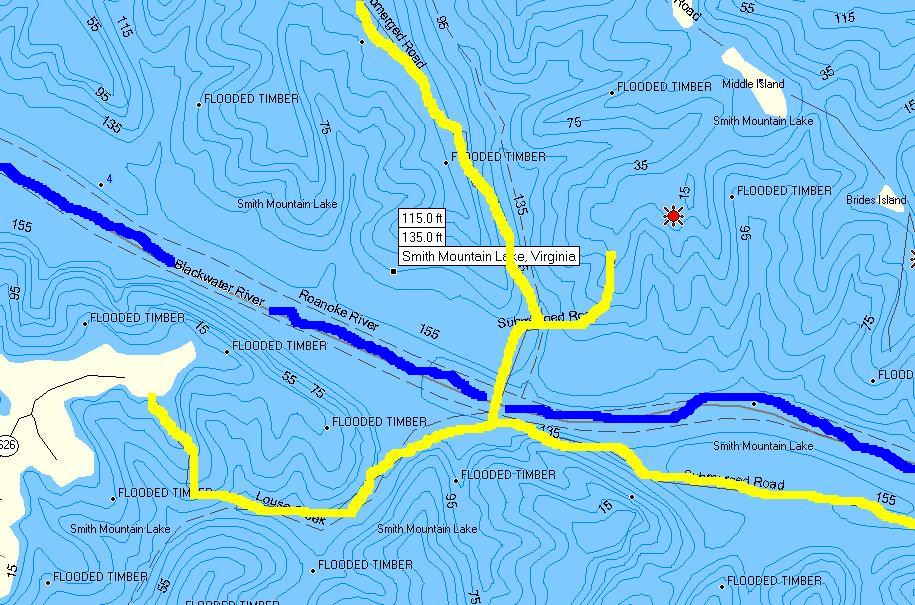
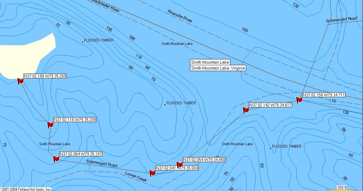
Oh and Ice9 - You should be able to use the USGS topographical survey overlays from back in the day to ballpark the depth once you determine your search area by comparing them to the current ones, and then determining the distance between them and vista point, ya mean?

Hah! Well, math isn't exactly my strong area... :D
 
Not a big deal, you have the topos? I can figure it out real quick.


On a side note, I emailed Todd Keith asking him about the town location, we'll see what he says.
 
So is anyone planning to go down and check it out?
 
Alright, given the request for a zoomed in map, I've copied a map of the area being asked. The upper right includes middle island and the smaller one below it. To the lower left is vista point - you can see the end of 626. I've highlighted the submerged roads in yellow, and highlighted the old blackwater river channel - you can see where it passes under the road.

2676671659_b96bddddf3_o.jpg


I too read on some sites/blogs/rumor accounts that the town sits in about 60 feet of water. I read the history of Monroe, Va and it said that where the old Louise creek ran down towards the blackwater river. You can follow the path of the old Louise Creek on the image as well - follow submerged 626 from vista point and you will see louise creek on the image.

I mapped the distances of the road - from 626 on vista point, following the submerged road down to the intersection of the three roads is .7 miles.

Here is an overzoomed copy (without me highlighting the roads or channels - you can see them yourself). I did add GPS latitude longitude data so you could follow the road or know where to anchor a boat to get in the general vicinity.

2677720282_ea01c1354a_o.jpg


MM
 
Last edited:
Perfect!

SML-GE-USGS-TOPO.png


So according to the Google Earth, USGS Photos, and your topographical info, that puts our town at 37° 2'6.18"N x 79°34'43.60"W in about 100ft of water. Mystery nearly solved, we just have to go down and confirm it! :D
 
Here is Keith's response:

The whole ‘town’ statement is somewhat of an exaggeration. I just mentioned to the reporter that they left everything down there, houses, bridges, etc. There was no real town in the area at the time. Just to let you know, scuba diving is somewhat dangerous down here because there’s standing timber everywhere in the lake and the timber is full of hooks and lures and I’ve heard from the rescue team that they don’t recommend recreational diving…. But if you’ve done it before down here, you should be fine.

I emailed him back saying that we had heard of an entire town with church/graveyard/market/etc and he replied

There's something like that at the S-Curves, near the State Park. I'm pretty sure that its at the mouth of Walton Creek around R19. They make a book that shows the aerial photography of the lake before it was filled. It's called "An Underwater Look at Smith Mountain Lake"


Man I love a good mystery. That book could logically solve this mystery. Will check amazon.
 
Besides the town, a few folks asked about bridges. There is a bridge that was submerged "Hales Ford Bridge" that is just south of the "New" bridge" that is SR122. Here is a link to an article that displays the new and old bridge shortly before the flooding of the valley. If you blow the image up, you will notice there are two buildings right near the old bridge. According to my Topo Maps, the old bridge lies in approximately 60-80' of water. The deepest part of the water is 95' and the bridge used to elevate over that depth.

Pics and history: History
 
I may be doing a trip there around the end of August...
 
https://www.shearwater.com/products/swift/

Back
Top Bottom