Tobermory Trip Report: Aug 27-31, 2007

Please register or login

Welcome to ScubaBoard, the world's largest scuba diving community. Registration is not required to read the forums, but we encourage you to join. Joining has its benefits and enables you to participate in the discussions.

Benefits of registering include

  • Ability to post and comment on topics and discussions.
  • A Free photo gallery to share your dive photos with the world.
  • You can make this box go away

Joining is quick and easy. Log in or Register now!

trucker girl

Cupcake, Queen of Dorks
Messages
2,300
Reaction score
1
Location
Off the road for good in April '08 and at home in
# of dives
100 - 199
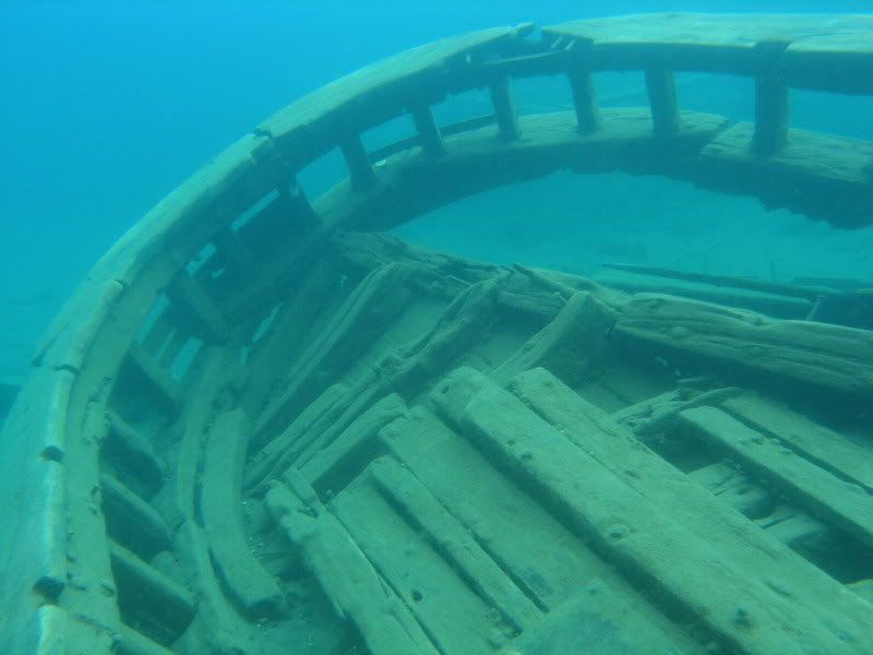
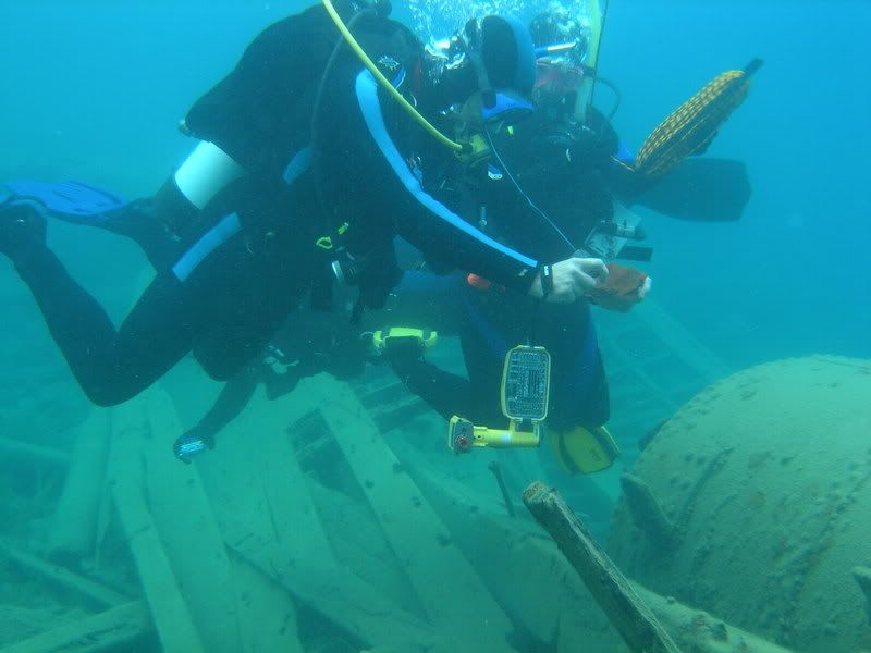
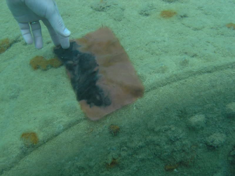
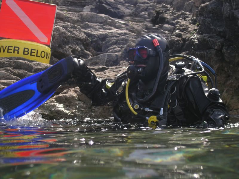
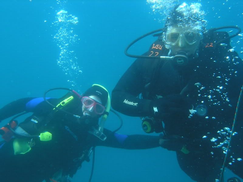
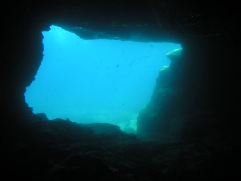
The following is my trip report for the trip organized by Ber Rabbit. The report is totally subjective and based on my experiences at the dive sites. Other divers saw and did different things and had different dive profiles.

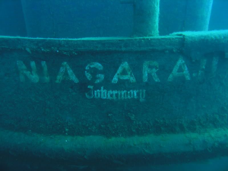
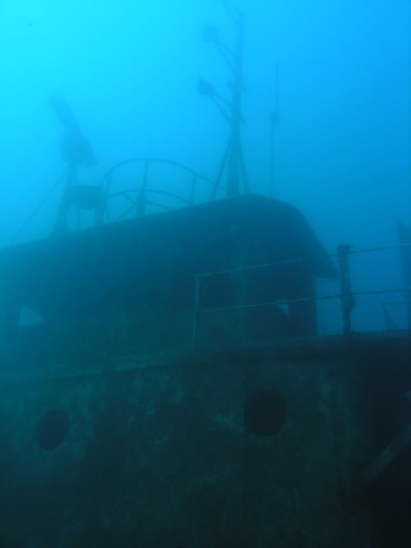
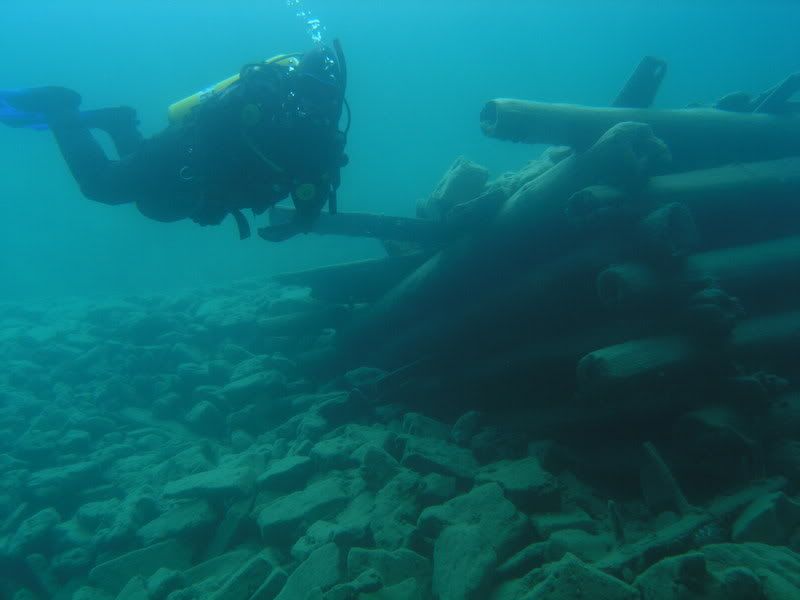
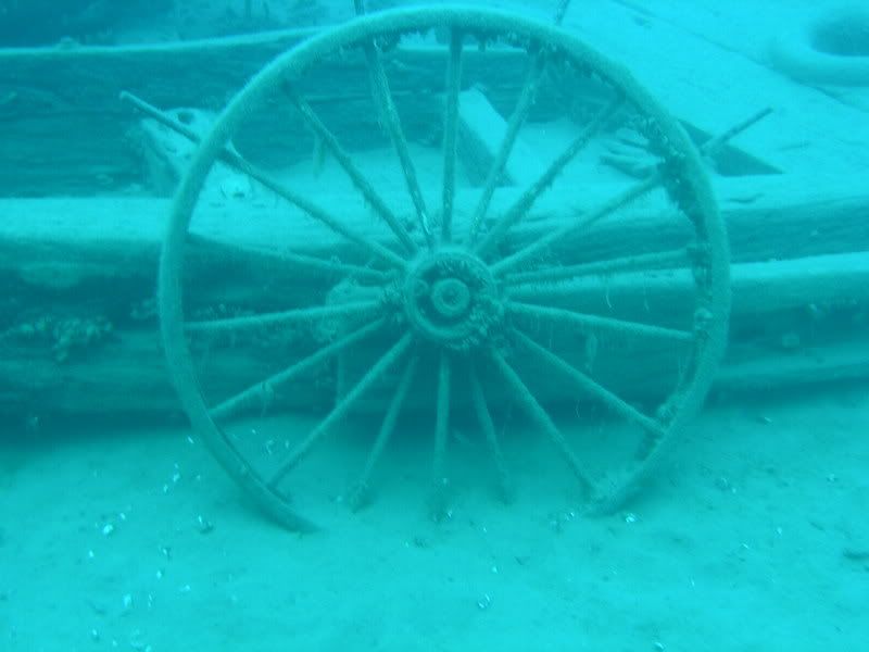
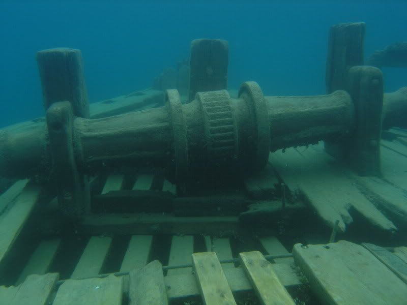
All of my information regarding the historical details of these wrecks come from the boat’s dive master from G&S Watersports, Tracy, and the books I borrowed from Ber Rabbit that were written by Cris Kohl, The Great Lakes Diving Guide, Dive Ontario!, and Dive Ontario, Too!

More Tobermory Information
and even more Tobermory Information!

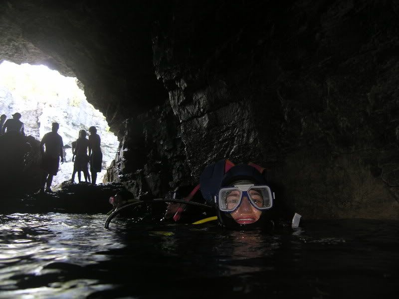
All of my dive log statistics come from my own log as recorded by my computer- dive times don’t represent bottom times, but, rather, total time surface to surface.

Ready? Set? Go!


(please forgive typos and mistakes... okay?)
 
Amber (Ber Rabbit) and Bruce, Ken (Notso_Ken), Steve (Steve_Dives), and Suzanne (trucker girl) met up in Sidney, Ohio, to caravan. After the border crossing, we stopped at a waterside park to stretch our legs and grab a quick lunch- hot dogs or corn dogs (Pogos), and fries.

We arrived in Tobermory around 4 or 5 pm and checked in at the Harbourside Motel. We stopped in with the dive shop to confirm our boat trip plans and drop off a couple of tanks for fills and then headed over to the Fathom Five National Marine Park visitor center to register and buy our dive permits- $5/day or $20 for the season. We are diving 4 days, so $20/season means one tag for the same price as four. The Fathom Five National Marine Park visitor center is newly built and very beautiful- there is an observation deck that none of us saw before we were already heading out that most likely provides a nice view of Little Tub harbor. We had dinner at The Fish and Chips Place and lounged around until about 8 pm when Paula(diver_paula), Adam (doc407) and Brian (two of Ber’s former students from the Dayton area) arrived- Adam and Brian drove up from Dayton and met up with Paula in Detroit to make their own caravan. The three were sharing a camp site and had to set up tents in the dark!

Long day. Goodnight!
 
We hotel-dwellers met for breakfast just before 7 am at the Leeside Restaurant. Then we headed down to G&S Scuba to pick up our tanks- my rentals and Ken’s and Steve’s fills. We met up with Adam and Brian, who were there to drop off tanks to get air fills. Adam and Brian had to head over to the Fathom Five National Marine Park visitor center to register and buy their diving permits. They got back from checking in just as their tanks fills were finishing and we all headed over to The Tugs dive site for our first shore dive. Paula decided that the morning shore dive followed too short of a night- and opted out.

The Tugs


There are four wrecks here, the Alice G (the most intact of the four), the Robert K, the Bob Foote, and the John and Alex. The Alice G ran around in bad weather. The other three burned and sank. We did most of our setting up and gearing up in the small parking area (parking spots for maybe 10 cars). Then we headed out to the water. There is a gravel walkway down to a porch-like, wooden entry platform. Steps lead down from the platform to the waterway.

We descended above the wreck that is located just past the entry- the Robert K- and headed west toward the Alice G. CDNscubamoose had promised that there would be a hidden treasure map (also known as a message- since I don’t think he left us any treasure) at the Alice G hidden under a square rock in the area of the boiler. We swam to the Alice G- a good ways over. We explored the area of the boiler area- Ken found a square rock and picked it up. There was a red cloth and a crayfish. He picked the red cloth. There had been something written on the red cloth at some point that was now washed away. Aye, me mateys, the ink hath faded- Davy Jones hath kept his treasure this day… sorry. That’s the best I could come up with on such short notice. We found out later that the message had been written on “wet notes” and decided that someone else must have intercepted the message and left another message on the red cloth- not realizing the ink would wash out.

After exploring around the Alice G for a bit, we headed back toward the other 3 wrecks. They are, west to east, the Robert K, the Bob Foote and the John and Alex. They are very broken down- mostly just piles of wood. One wreck has a large section of the railing at the stern of the ship that is still recognizable.

Max logged depth 37 feet while swimming to the Alice G- most of the dive was spent around 8-12 feet. Total time surface to surface, 41 minutes. Water temp 61-63 degrees F.

We finished our dive, packed up and headed back to the hotel. We decided to meet back up at 2 pm at the entry for The Anchor, our second shore dive.

The Anchor


The entry to The Anchor site was slightly more hazardous than that for the Tugs. A rainstorm had blown through between our shore dive at the Tugs and this dive, but we were spared any increased wave activity. We took the dive flags down to the entry and returned to the gravel-, dirt- and pine needle-lined parking area to gear up (tarps or mats and a tail gate are a good idea for gearing up at this site). Then we headed down- very carefully and slightly off-kilter. The footing is unsure, even without full scuba gear, but we all made it to the water safely (though you couldn’t describe us as graceful!).

We all tumbled into the water, and descended. Ber and Bruce were in the lead with the rest of us following. We probably should have asked CDNscubamoose to leave us a map to the anchor instead of a treasure map, because we completely missed it. Despite failing to find the anchor, the dive was enjoyable. The geology is quite interesting, and though there are few fish other than the gobies, the water is clear. That alone is a nice change from the often mucked-up quarries we frequent!

After the dive we pulled ourselves out of the water and up the rocky terrain with an audience of about 8 non-diving tourists. Nothing like watching a bunch of neoprene and dry-suit clad aliens flailing their arms about while they try to keep balance. Now do you want to give scuba a try?

Max logged depth 47 feet- most of the dive spent at 20-30 feet. Total time surface to surface, 37 minutes. Water temp 62 degrees F.

We met for dinner at 5:30 and drove over to the Grandview Lodge near the entry for the Tugs dive site. Meals are a bit more pricey there (meals $20-$30), but the food was excellent.
 
We met at the Leeside Restaurant for breakfast again, then took our scuba gear down to the boat dock.

Niagara II and Caves


The Niagara II is a 180-foot-long former freighter and sand dredge. She was put into service in 1930. She is not a wreck but, rather, was purposely sunk in 1999 to provide another dive site. We had about a 30 minute boat ride to the site- the dive master, Tracy, gave us a 10 minute warning- most of use were already mostly suited up at that point. We hopped in the water and pulled ourselves to the front of the boat to descend. The buddy pairs were Ber and Bruce, Ken and Steve, Adam and Brian, and Paula and I. We descended and explored the length of the deck- peeking through port holes, exploring various openings- bunk rooms, the wheelhouse, etc. We somehow all ended up on the line at the same time for our safety stops!

Max logged depth 81 feet. Total time surface to surface, 30 minutes. Water temp 55 degrees F.

We had a beautiful trip to the next site- sunny and warm. The water was calm, so we were able to soak up the sun, as well as the view.


The Caves site was filled with swimmers. There is a long stretch of shallow shoreline and a grotto area- the caves underwater open up to a cave that is accessed from land as well. The diving guides I borrowed from Ber said that skinny dippers like to swim in the grotto… there were none there this day, though. The caves are more like caverns than true caves. There is a slight overhead environment, but it’s not very long, and two of them open up into the grotto. We swam toward the first cave to enter the grotto. We stayed low to avoid getting landed on by cliff jumpers and swimmers and swam through to the open-aired grotto beyond the first cave. We ascended to take a look around and wave at the swimmers and those sitting on the rocks. We descended again (we’re talking 10-15 feet, here) and went out the second cave- much smaller. Tracy, on the boat, had suggested entering through the first cave and exiting through the second, since the second is smaller, and the light coming from outside the grotto would guide us through the smaller cave. We explored around the third cave and then headed across the cove-like area to the 4th and 5th caves. Paula and I wound up a little closer to the swimming area (in 10 feet of water) than we had intended and we gave some swimmers a thrill- a dad and his two young daughters were very excited when they realized we were swimming along below them. I’m not sure Paula and I found the last two caves, but we did explore a lot of interesting rock passageways. We headed back to the boat.

Max logged depth 26 feet. Total time surface to surface, 29 minutes. Water temp 61 degrees.


During our short dive, the weather changed- the beautiful, sunny day had turned overcast and cool. We had an hour-long boat ride back, and only an hour for lunch before we were to leave out on the afternoon dives. Adam, Brian and Paula opted out of the afternoon charter in favor of shore dives and other activities. Ira and Kendall joined us for the afternoon dives.

Minch and Sweepstakes


The Minch is a 154-foot-7-inch-long schooner that sank during a storm in 1898. She was built in Vermilion, Ohio, in 1867. It’s really nothing more than a collection of wood pieces strewn along the edge of the harbor (the Tecumseh harbor, named for the ship, Tecumseh, that had previously sunk there). We descended in buddy pairs (I was asked to pair with an insta-buddy, but tried to stick nearby Ken and Steve) and explored the wreckage.

Max logged depth 45 feet. Total time surface to surface, 49 minutes. Water temp 61 degrees F.

It was raining when we ascended and we had a cold, wet trip to the next dive site.


The Sweepstakes is a 119-foot-long schooner that ran ashore in 1885. She was towed into the harbor for repairs, but sank before they could be made. The Sweepstakes was built in Burlington, Ontario, in 1867. The glass-bottom boats tour this area- the Sweepstakes is no more than a few feet from the surface, and we were not able to dive there before 4pm so that the glass-bottom boats could have free access to the site earlier in the day. The others explored both the Sweepstakes and City of Grand Rapids wrecks. I ended my dive after exploring the Sweepstakes because I got too chilled to continue.

Max logged depth 21 feet- most spent at 3-10 feet. Total time surface to surface, 15 minutes.

During our dives, Adam and Brian attempted a shore dive to the Sweepstakes- they got close but gave up before they got there.

We had dinner at The Fish and Chips Place again and retired to our rooms.
 
Breakfast at the Leeside Restaurant, then headed down to the docks.

San Jacinto and City of Cleveland

The San Jacinto is a schooner that sank in 1881. She was built in Buffalo, New York, and launched in 1856. The wreck wasn’t discovered until 1990. We had a 2 hour boat dive to get to the San Jacinto- there were two-foot waves, but nobody got seasick. The site was pretty well mucked up after a couple other divers descended and weren’t paying attention to what their fins were kicking up- no one from our group. Training in quarries with peer pressure takes care of all kinds of fining issues! At the stern of the San Jacinto, the anchor sits upright at an angle- covered with a lot of goo, but clearly recognizable. There were several deadeyes on and beside the deck- deadeyes were used as pulleys for the lines that controlled the sails.

Max logged depth 76 feet. Total time surface to surface, 28 minutes. Water temp 57 degrees F.

The boat ride to the City of Cleveland was in significantly calmer waters- and, despite the chill in the air (accented by the wind), the sun warmed us up.

The City of Cleveland had twin decks, four masts and a wooden propeller. She was 255 feet, 7 inches long and sank during a winter storm in 1901. She was built in Cleveland, Ohio, and launched in 1882. This is an amazing site! The ship is mostly broken apart- but the load of iron ore she was carrying is still lying about, and the ships moving parts are visible, as are the structural aspects. I lack the vocabulary to describe it properly. The propeller is completely visible above the lakebed and the wooden rudder lies just beyond it. The steam engine and boilers are also recognizable (if you know what you’re looking at- which I don’t!). There were a lot of crawfish around the deck. When Paula swam by, they would come scooting out of their hiding spots to attack her shadow- I played with a few of them, one got upset and attacked, pinching my glove.

Max logged depth 25 feet. Total time surface to surface, 29 minutes. Water temp 61 degrees F.

During the 3 hour boat ride back to Little Tub Harbor, the offer was made for a third dive at a shallow site. We had all already packed away our gear and gotten warm and dry, and the dive was a wall dive- similar to the swim to the Anchor site and the Lighthouse (which we didn’t dive this trip), so no one was too motivated to take the offer! We returned to the harbor, cleaned up and had dinner at the wood-fired pizza place. It’s a take-out pizza joint so we ate at picnic tables by the harbor. After dinner, we met up for a picture-swap and makeshift internet café outside Ken and Steve’s room!
 
Breakfast at the Leeside Restaurant again, then packed up the cars with our gear and clothing and headed to the boat dock. We had a short boat trip- about 25 minutes out.

Arabia and Wetmore

The Arabia is the pinnacle of Tobermory diving. The Arabia is a 131-foot-long barge that sank in 1884. She has three masts. The Arabia was built in Kingston, Ontario, in 1853. The bow of the Arabia is almost completely intact. We headed out of Little Tug Harbor a little late (the crew forgot toilet paper) but soon overtook the other boat that was headed to the Arabia. That meant we got to pick which of the two mooring lines the boat hooked to- one at the bow and one at the stern. We wanted the bow, because the bow holds the most interesting and beautiful sights. As we descended into the cold darkness, there was nothing to see. And then, the Arabia appeared. We swam from the buoy line to the ship- about 30 feet. My buddy, Steve, and I chose to keep a conservative dive profile, exploring only the bow area. We looked for the three anchors we had been told- two are easy to spot, the third is somewhat hidden- all three on the deck of the bow. One was originally used on a ship other than the Arabia and the name of the other ship is clearly written on the anchor- most likely the anchor is from a decommissioned ship which had been parted out. The anchor is possibly the oldest artifact on the Arabia and may date into the 18th century. Chains still hang elegantly from the anchors on the outside of the bow. Deadeyes still sit along the rail of the bow. This was an amazing wreck to explore, but also dangerous. It is easy to become disoriented or underestimate the amount of air you will need to ascend.

Max logged depth 88 feet. Total time surface to surface, 26 minutes (started the ascent at 14 minutes). Water temp 53 degrees F.

Another short boat trip- just a 45 minute surface interval.

The Wetmore is a 231-foot-7-inch-long steamer that sank in a storm in 1901. She was built in Cleveland, Ohio, and launched in 1871. We swam from the boat to the Wetmore, coming to the wreck near the wooden rudder, propeller, and boilers. We swam along the length of the wreckage, exploring the structure of what is left of the Wetmore. We then came to the huge anchor and massive pile of chain that is a key feature of the wreck. The chain is piled up, indicating that the Wetmore sank very fast, as opposed to being strewn along a length of the lakebed, which would indicate that she went down slowly, dragging the anchor behind her as she sank.

Max logged depth 18 feet. Total time surface to surface, 39 minutes. Water temp 62 degrees F.

We got to the boat dock and loaded all our wet, stinky gear into cars. We met up at The Fish and Chips Place for lunch and logs and then headed for home (I think I was the only :dork2: who met for logs...).
 
Here are Steve's stats from the Tobermory trip thread...

Steve_Dives:
The Tugs
47 feet, 45 minutes, 64F surface, 61F min temp

The Anchor
47 feet, 43 minutes, 65F surface, 59F min temp

Niagra II
84 feet, 30 minutes, 64F surface, 54F min temp

The Caves
43 feet, 34 minutes, 65F surface, 62F min temp

The Minch
44 feet, 47 minutes, 65F Surface, 63F min temp

The Sweepstakes
25 feet, 40 minutes, 66F surface, 64F min temp

San Jacinto
79 feet, 24 minutes, 62F surface, 59F min temp

City of Cleveland
26 feet, 45 minutes, 63F surface, 61F min temp

The Arabia
92 feet, 26 minutes, 64F surface, 52F min temp

The Wetmore
19 feet, 42 minutes, 65F surface, 64F min temp
 
Nice report TG! Thanks for leaving out the reviews of my singing on the ride up & back! :D
 

Back
Top Bottom