Nautical chart symbols

Please register or login

Welcome to ScubaBoard, the world's largest scuba diving community. Registration is not required to read the forums, but we encourage you to join. Joining has its benefits and enables you to participate in the discussions.

Benefits of registering include

  • Ability to post and comment on topics and discussions.
  • A Free photo gallery to share your dive photos with the world.
  • You can make this box go away

Joining is quick and easy. Log in or Register now!

For details about all the different doohickies on a nautical chart, refer to a book called Chart #1 by NOAA. It is the legend for all the symbols and stuff.

Did, and didn't see them. Perhaps I missed that section. But thanks, I did download that chart.
 
Did, and didn't see them. Perhaps I missed that section. But thanks, I did download that chart.

Usually in the margin of the chart you will see "LORAN-C OVERPRINTED" that's what that means...
 
See, I'm learning all sorts of new stuff!
 
No, they don't. It is nowhere near as accurate as GPS. The signals bent and got distorted. And didn't have worldwide coverage even in its heyday.

I know many that would beg to differ with your accuracy statement. Depending on where you were (and specifically off the Jersey Shore), accuracy was incredible. The Great Lakes chain was frequently in error due to overland transmission of signal, yet was one of the last ones that was kept going.....

GPS (prior to the elimination of SA) was no way near as accurate, and in fact, DGPS was developed as a radio signal correction because the military degraded the signal accuracy. Now, if you want to discuss "survey grade" GPS, then we are talking (as in lots of money), yet there is still real-time-correction utilized through the cellular network. Accuracy is then sub-centimeter. Your GPS is likely off by 10-20 feet or more.

I agree that inaccuracies were caused by interference from land. Which didn't affect all locations. But because the accuracy varied, if you were not familiar with the local situation, you could be misled into expecting better than you got. You comment about NJ, I might be remembering wrong, but I seem to remember a spot off of the southern tip of NJ that sort of skipped a loran line. But that was maybe 25 years ago so I could be remembering wrong. I also agree about GPS accuracies. I can remember leaving NY harbor in the big ship channel, (Ambrose), but the GPS put me outside of the channel. But generally the accuracy was consistant.

Worldwide coverage was incomplete, because it depended on governments having enough interest to invest in installations. Once all of the satellites were up, GPS was world wide. I can remember when RDF was the only way to approach Bermuda, and thats not what I would call remote.

No electronic navigation system should be trusted for very tight harbor entries or passages, unless you know the accuracy of the chart. As mentioned earlier, not all charts have been updated with gps based coordinates. In remote places, the picture of the island might be perfect, but the whole thing is off by alot more than 10 or 20 feet, because its placement was done with celestial methods.

Both systems have decent repeatability, however, so what was under a certain coordinate one day, should be there the next.

Sorry. I got carried away. I know that this is a diving forum. For a moment I slipped back into a past reality.


When I was sailing, I kept a sextant and current nautical almanac on board, but thats another topic.:wink:
 
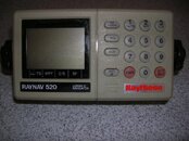
RayNav 520.jpg


LORAN was a super accurate system of radio navigation before GPS became all the rage.

I cold pinpoint a shipwreck with 3 ft dia repeatability with LORAN while a GPS with Differential can only get down to 10 meters.

every commercial boat kept there numbers for hangs in TDs and they were wourth there wieght in gold.


Want t to by a RAYNAV 520 with coupler really cheap?

Like new. Just $50.

Capt@WickedGoodOutdoors.com
 
Loran huh? Every Navy ship of merit had a Loran set, but geez, no one actually used the POS'es too much. The non-SINNs vessels had SATNAV and two people shot stars at 2000. Loran... yeah, uh, great.
There is nothing like the feeling of shooting six stars with a sextant in the open ocean and having all the lines criss-cross to a dot 'cause that's where you were exactly on Earth. Nice while solo steaming.
On adding stuff to charts, I added "Monster Island" once to the approach briefing to Sasebo in southern Japan on one of my nav briefings - there are a lot of little islands to consider where you're driving a carrier Battle Group through at 0-dark30, so what was one more?
I figured maybe Raymond Burr knew something that the rest of us didn't.
 
I navigated for years finding dive sites with loran. Repeatability was fantanic as close as 5 feet. By that I mean using the same loran receiver to go back to the same known spot. Using another receiver or a position determined by another receiver not quite as good but still close enough. Using a calculated position from a chart not so great, might require considerable searching.
 
https://www.shearwater.com/products/swift/

Back
Top Bottom