DM Map

Please register or login

Welcome to ScubaBoard, the world's largest scuba diving community. Registration is not required to read the forums, but we encourage you to join. Joining has its benefits and enables you to participate in the discussions.

Benefits of registering include

  • Ability to post and comment on topics and discussions.
  • A Free photo gallery to share your dive photos with the world.
  • You can make this box go away

Joining is quick and easy. Log in or Register now!

I guess this also depends on what you term a 'dive site'...

If referring to creating a map of the 'quarry' it might actually be overkill to do the whole thing but a better apprach may be to take on area that you well cover in a couple of dives, especially an area that you may cover with OW candidates doing their checkout dives and map this.

This way it does not take you the entire summer but is could also be immediatly useful in giving the OW candidates a good background to what they will see while doing their checkouts.
 
When I asked this question, as an instructor evaulating my first DM candidate, one of the better responses (to my way of thinking) was that this should not take more than two dives. If it does, then that is an indication the candidate isn't well organized and efficient

I've only just spotted this. Although I agree that the target for the DM candidate by the end of his/her training is to be able to draw a useful map quickly, it usually takes a process of trial and error for the candidate to reach that stage. It isn't until the candidate has tried presenting his dive plan including the map to real divers that he appreciates what's important to include.
 
I guess this also depends on what you term a 'dive site'...

If referring to creating a map of the 'quarry' it might actually be overkill to do the whole thing but a better apprach may be to take on area that you well cover in a couple of dives, especially an area that you may cover with OW candidates doing their checkout dives and map this.

This way it does not take you the entire summer but is could also be immediatly useful in giving the OW candidates a good background to what they will see while doing their checkouts.

I concur...a dive location could contain may different dive sites. IMHO, the aim of the exercise is to map a very specific section of an area of interest. I also think this is where both candidates and instructors have to manage expectations to avoid mission creep and create a monster. If the instructor allows for a group project, one would assume a greater area being covered and probably more granularity as well.

Ideally, the area or site selected should be one that the candidate is also familiar with especially if it is a one individual project. Just like Jim mentionned, not only you can build upon it but you can also do it backwards...ie revisit your previous dive profiles and your logbook to support your project. I recall a topic on SB dealing with maintaining diving logbook... This is one very specific instance where previous notes and downloadable dive profile software will save you some time and possibly work.

There are also many other tools out there that are available to assist the individual(s)... Internet (Google Earth, pictures, maps), marine chart and GPS just to name of few. Why would I want to spend time drawing the outline of a quarry or lake when I could you find an overhead picture, blow it up to give me the details (access points, facilities and visual representation of the site) that I need and then add distances, heading, depth and structures...just to name a few. Better yet, if you happen to have a paper or electronic copy of a marine chart (in my case, Bluechart as I use Garmin GPS), then by establishing entry points (GPS), heading and distance, structures can then be pinpointed fairly accurately with the chart already providing the contour depth. A typical dive profile representation (from your dive planner/diving software) can then be pasted to your project to reflect time, space (depth) and temperature especially if your dive computer allows bookmarks...

Pinpointing structures...I like the initiative the individual displayed of using empty plastic pop bottles and strings (when practical)...because you could either take their GPS coord once on the surface or use a compass and triangulate their locations based on known positions.
 
If the instructor allows for a group project, one would assume a greater area being covered and probably more granularity as well

Point of semantics - you mean finer granularity. More granularity can mean in different contexts either finer or coarser granularity.

This is an interesting discussion on how to draw the map, but the real question is "what should be drawn?". As part of a DM course/internship it is intended to guide the prospective DM towards doing something that will be useful to the qualified DM, and that is a map whose function is to form the basis of a briefing for an individual dive. Nothing more nor less. Anything the divers would wish to know should be included, and information that would not be relevant to their dive should not be included. It can be brought in in a post-dive review, but if presented beforehand will merely serve to overload and confuse.

This is not an exercise in map drawing (cartography) but in a pre-dive briefing supported by a sketch map.
 
I've kinda skimmed through this post but I didn't see the specific standard mentioned so to quote from the PADI Instructor Manual:

Have divemaster candidates survey an open water dive site and create a detailed map of the site showing (as applicable to the site) underwater relief, important points of interest, any relevant environmental notes, recommended entry/exit areas, local facilities, and potential hazards.[\quote]

I think it's a good exercise for the DM candidate and in one of my previous jobs teaching professionals at a busy CDC, I saw a lot of awesome maps - and some crappy ones, to be fair. I think it can be more than simple preparation for a life drawing maps on whiteboards as part of your dive briefings. If you have a group of DMTs together then it's a great exercise in teamwork and planning as well as dive and navigation skills. It doesn't have to be perfect, but it should be something another diver can look at and find their way around.

The requirements do vary from instructor to instructor but also from location to location. A map of our house reef could be sketched in minutes and it would be easy to find your way around without compass bearings. If, on the other hand, you dive in poor viz and over a lot of featureless sand, then accurate directions become essential.

I used to vary my approach (I had big classes) so sometimes I would take the candidates some place they had never been to before (one class mapped a newly sunken wreck), sometimes I would let them pick their own dive site, sometimes I wouldn't tell them where we were going so they had to improvise when they got there.

Most of the time it was also great fun.

Cheers

C.
 
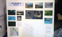
finally finshed it \o/ this was the last requirement for most of us on the course, so it's all down to finishing the paperwork and getting our damn cards!

I'm not 100% happy with it but it's done and the store like it. they wanted an accent on photos and the map rather than text so we included the google maps map to give a general overview then I did the AutoCAD drawing to give better detail of the site.

the site is a bit of a rubbish site, I would have preferred to do a better site like freshwater beach (sydney, Aust)... but we didn't have a choice.
 

Attachments

  • IMAG0026_.jpg
    IMAG0026_.jpg
    389.5 KB · Views: 114
And, a fine map it is!
 
Just how much detail is expected when doing the mapping of a dive site for the PADI DM course? Not sure I get the reasoning behide doing this, already done nav course.

Depends upon the instructor.

But at the end of the day, you get out of it that which you put into it.

the K
 
it was described to us as "include the required information to read the map, drive to the site, conduct a safety plan with your buddy and use the map as the dive plan"

which i guess can range from a google maps screen grab with a X marking the entry point and a dotted line around the suggested dive to a fully blown 3-D model marking everything of minor and major significance and complete historical run-down of the site.

p.s. thanks hypertech, while I'm a perfectionist and would have loved to spend more time on it, our instructor said it was pretty good :D
 
BlueHole-3D-2.PNG


I did my map about four years ago. My dive buddy and I ran a line that was knotted every ten feet due north and south and used that as our main segment. We took depth readings at each knot. We then did two arm spans (guesstimated it to be about 10') from the knots east and west, and took depth readings from there. Once we were done, I plotted it on contour software. It took the two of use three dives to complete, working as a team. It could be done just as easily in low-viz with a little patients, a compass, and a level head.

Of course my map is a little out of the ordinary compared to most DM maps. Have you ever been on a charter and have the DM draw out a map on the fly of a dive site? As a DM, to be able to lead dives, you need to be know the dive site and be able to navigate around it competently. That's my interpretation of what the dive map is for.
 
https://www.shearwater.com/products/peregrine/

Back
Top Bottom