Next weekend's weather. UGH...

Please register or login

Welcome to ScubaBoard, the world's largest scuba diving community. Registration is not required to read the forums, but we encourage you to join. Joining has its benefits and enables you to participate in the discussions.

Benefits of registering include

  • Ability to post and comment on topics and discussions.
  • A Free photo gallery to share your dive photos with the world.
  • You can make this box go away

Joining is quick and easy. Log in or Register now!

Did you click the spoiler?

The computer projections keep moving around, but Wednesday still looks moderate. Hoping for the best...

Yes, I am just trying to give as good as I get..... :mooner:

The Crowne guy Tropical Weather Discussion Crown Weather - Your One-Stop Weather Information Source - US Weather, Tropical Weather, and More! is saying:

If this system continues to organize the way it is, I suspect it may be upgraded to a tropical depression within the next 24 hours. Invest 92-L is forecast to track into the Yucatan Peninsula just south of Cozumel Wednesday afternoon and then track over the Yucatan Peninsula Wednesday night before making it into the northern Bay of Campeche Thursday morning. I do think that this will be Tropical Storm Karl when it comes ashore on the Yucatan Peninsula. Once it is in the northern Bay of Campeche, it will have about 60 hours over very warm waters to develop and intensify.

Even a tropical depression is nothing more than a lot of rain and "norte" force winds - nothing to be concerned over. The satellite image doesn't even look as bad as some of the recent rain we've had:

at201092_sat_2.jpg
 
Even a tropical depression is nothing more than a lot of rain and "norte" force winds - nothing to be concerned over. The satellite image doesn't even look as bad as some of the recent rain we've had:

at201092_sat_2.jpg
That picture was at 8AM and the edge of the cloud bank looks to be about 60 miles away from you. It looks like the rain will be starting at about noon. Whatever wind there is will likely be mostly from the east. Surf's up at Mescalito's! :D
 
That picture was at 8AM and the edge of the cloud bank looks to be about 60 miles away from you. It looks like the rain will be starting at about noon. Whatever wind there is will likely be mostly from the east. Surf's up at Mescalito's! :D

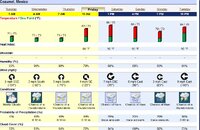
If I am reading all of this information correctly, with the exception of some scattered showers looks like by Friday things should be pretty clear and a good weekend of diving will be at hand..
 
If I am reading all of this information correctly, with the exception of some scattered showers looks like by Friday things should be pretty clear and a good weekend of diving will be at hand..
Friday looks nice, subject to change.

Click to enlarge: Coz.JPG

Or click here
29pxf28.jpg
for larger view
 
Now Tropical Storm Karl but not much of a threat still...

at201013_5day.gif
 
From the satellite it looks like its about as bad as its gonna get for coz right now.

no wind, no rain other than a brief shower around 7:30pm

right now some thunder and lightening, no rain or wind and the ocean is like glass
 
no wind, no rain other than a brief shower around 7:30pm

right now some thunder and lightening, no rain or wind and the ocean is like glass
The calm before the storm...?

That may well change as the hourly forecast has significantly, and it looks like a thunderstorm is happening now? Nothing like the Cat 1 or 2 originally expected and it is a near miss for Coz, but if the current forecast holds - the port may close by noon. The good news is that the wind is out of the east so maybe not. Afternoon ferry rides may be bumpy but they should have plenty of barf bags. :eyebrow: I just sleep thru crossings. Cozumel, Mexico Forecast : Weather Underground

Karl will have another chance on the other side of the peninsula and looks like he might make Cat 1 then, but he'll be long gone for y'all by then. Thursday thru the weekend looks very mild.
 
Lots of intermittent rain last night. We lost a couple of palm fronds due to one burst of wind about 3am. Storm is making landfall now at least 75 miles South of the island. Everything is soaked (good we needed it). Should be a semi-squally day, but by tomorrow everything should be back to normal. In my experience once any storm has passed the weather immediately following is usually really nice and clear. Although the effects here were less than a normal Norte the storm did get within 10mph of hurricane strength before landfall.
 

Back
Top Bottom